ArcGIS GeoService
Dataset description:
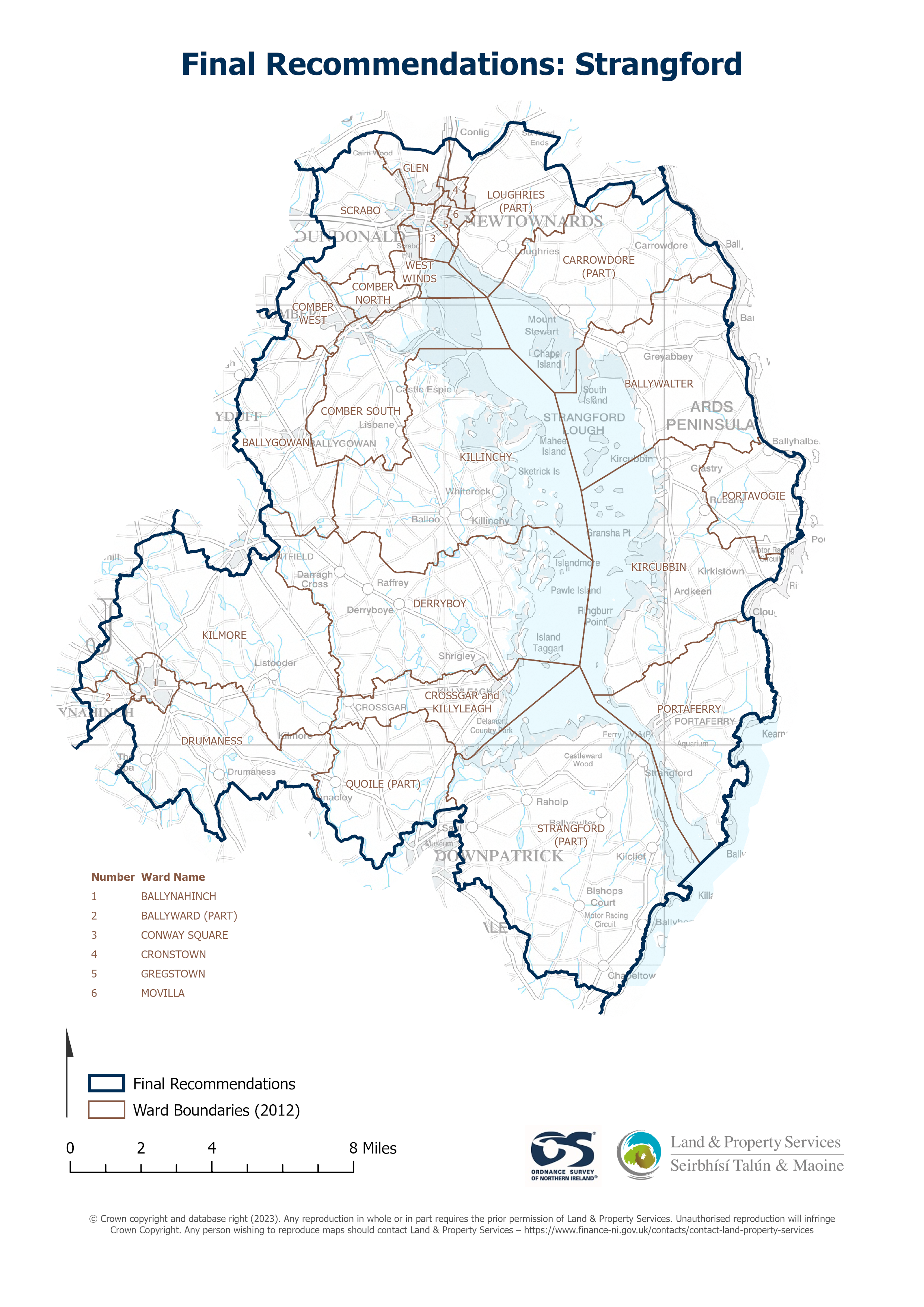
Raster download of Parliamentary Constituency 2023 of Strangford. The OSNI Large-scale Parliamentary Constituencies boundaries is a dataset consisting of official boundaries as agreed by...
Source: OSNI OpenData - Parliamentary Constituencies 2023 - Strangford
There are no views created for this resource yet.
Additional Information
| Field | Value |
|---|---|
| Data last updated | 22 August 2025 |
| Metadata last updated | 27 August 2025 |
| Created | 22 August 2025 |
| Format | JSON |
| Licence | UK Open Government Licence (OGL) |
| Access url | https://docs.spatialni.gov.uk/OpenData/OSNIOpenData_ParliamentaryConstituencies2023/PC2023_Strangford.png |
| Datastore active | False |
| Distribution ref | N140a1e668cab47b9bfbfd09db0bbf736 |
| Has views | False |
| Id | 2dbb44da-b969-42ee-9e80-781977d46225 |
| Mimetype | application/json |
| Package id | 47ed4aaf-64a3-49dd-a5c6-b437e932ba39 |
| Position | 1 |
| Requested | False |
| State | active |